
Walking a Chesterfield Street by Address
For a street-by-street search, begin with the county assessment record instead of the deed index. Chesterfield Real Estate Assessment Data, or READ, accepts broad address or name text and leads to the parcel number, current owner, situs address, tax mailing address, subdivision clues, and property history. The mailing address may be useful for locating an owner, yet it can be a post-office box, business office, or another residence. It is not proof that the owner occupies the parcel. Keep the parcel ID and legal description with each result because those details make later deed and plat checks far more reliable.
- Enter the address in READ and save the parcel ID, situs address, owner name, tax mailing address, subdivision, and legal description.
- Open the same location in the Chesterfield Parcel Viewer and click nearby parcels one at a time.
- Use the parcel owner name to search the Chesterfield Land Records index as a grantee, then identify the seller on the purchase deed.
- Search that seller as a grantee in an earlier period, matching legal description and lot details rather than a surname alone.
- For a current voter-status question, use the individual Virginia Citizen Portal; it is not an open whole-street browser.
- For an older occupant clue, ask Central Library about reverse or criss-cross volumes and compare the printed address with the parcel trail.
A criss-cross volume is an address-first directory. It can be useful for a dated occupant clue, but the exact Chesterfield run is not posted online and should be verified with the local-history desk.
Chesterfield Street Directory Searches in READ
READ is the county's strongest starting point for a Chesterfield street directory inquiry because it is keyed to assessed real estate. The public landing page documents a broad basic search and a substantial set of filters. Use the broad text field for an address or name, then narrow only when the initial result set is too wide. The county did not publish the exact labels on a rendered parcel card, so this field list uses the verified application keys and does not promise labels that have not been displayed publicly.
| READ field | Input | Format or choice |
|---|---|---|
| Basic search / baseSearch | Text | Broad address or name text |
| Subdivision | Selector or text | County master-data values |
| Sales date minimum and maximum | Date pair | YYYY-MM-DD format |
| Sales price minimum and maximum | Number pair | Numeric range |
| Year built, finished square feet, lot size | Number pairs | Minimum and maximum values |
| Bedrooms, full baths, half baths | Integer pairs | Minimum and maximum values |
| Magisterial district | Selector | County district values |
| Residential and commercial | Toggles | True or false choices |
| Active and inactive | Toggles | Both default to true |
| Improved and unimproved | Toggles | Both default to true |
| Building use code | Selector | County master-data code |
| Stories, style, basement | Selectors | Residential characteristic values |
| Sort and rows per page | Selectors | Default result page holds 10 rows |
Parcel details can include improvements, assessment and ownership history, dimensions, remarks, tax history, sketches, and print routes. Assessment data may lag a recorded deed, so the current READ owner should be checked against the recorded purchase document before drawing a conclusion about a Chesterfield address.
Chesterfield Street Records Defined
Several identifiers can point to the same property, and they serve different roles. Chesterfield street records are less confusing when the address fields stay separate. READ works from the parcel record, GIS uses map geometry, and the Clerk's index uses parties to a document. A street number alone may change, be abbreviated in an older directory, or fail to distinguish lots with similar names.
- Parcel or tax ID
- The county identifier for a specific tract. Chesterfield requires a 15-digit tax ID on deeds under Va. Code § 17.1-252.
- Situs address
- The physical location of the real estate. It is different from the place where a tax bill is sent.
- Plat
- A recorded map showing a subdivision's lots and boundaries. The Clerk's recorded plat is the official one.
- Criss-cross directory
- An address-first printed directory that may place an occupant at a street number for a particular year.
Use the legal description, subdivision, lot or block as the durable bridge between a modern street result and an older deed. A map display is helpful context, but it is not a land-conveyance document.
Note: Save the legal description before searching a common owner name, because the same person or entity may own several Chesterfield parcels.
Chesterfield Parcel Viewer Street Context
The county GIS hub links to a Parcel Viewer with parcel boundaries, subdivisions, schools, and political districts. Search the street or address, click a parcel, and use the popup or detail route to compare it with READ. Keeping the parcel layer visible while moving along a road is a practical way to separate the front, side, and rear tracts that share a street name. GIS also offers geographic context such as land use, hydrography, floodplain, and planning layers.
The READ assessment search opens the property path used for this Chesterfield street directory research.
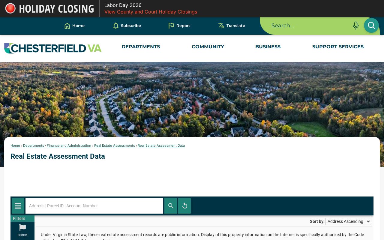
The screenshot shows the assessment search interface, where a broad property query can become the parcel and owner trail needed before a name-organized deed search.
Do not treat a geographic layer as proof of title or occupancy. The county describes the map as a reference tool, while a recorded plat or deed is the authoritative record for its separate purpose.
Chesterfield Street Deeds Need Names
A Chesterfield street directory search cannot be pasted into the land-record index as an address query. The Clerk's free index is organized by grantor and grantee names, not street address or legal description. READ and GIS therefore supply the bridge: record the current owner, parcel ID, subdivision or metes-and-bounds language, then search the owner's name as grantee near the likely purchase period. The matching document can identify the grantor, recording date, book and page or document number, consideration, and legal description.
Search the seller from that document as a grantee in earlier dates. Test initials, married or maiden variants, estate names, trustee names, and entity names. If the online result does not expose an image, the Circuit Court Clerk's Record Room offers inspection, and copies cost $0.50 per page with $2 added for certification. The Clerk cannot perform a title search or give legal advice.
Note: The online deed index reaches 1967 forward, so an older Chesterfield street trail must continue in courthouse books, Library of Virginia microfilm, or FamilySearch catalog records.
Chesterfield Address Records in ELM
Chesterfield's ELM Community Development Citizen Access Portal adds a different sort of address evidence. Permit and inspection entries can show a record number, address or parcel, permit class, application or project status, review and inspection status, comments, approved documents, and certificates of occupancy where the portal makes them public. A permit can help date construction, an addition, demolition, or major renovation. It does not establish the full set of people who were present at the address.
ELM Community Enhancement also permits address or record-number searches for code concerns. Its public depth varies, and a complaint is not proof that a named person acted or lived at the location. Treat it as a lead to a county record, not a conclusion. The county lists permit, inspection, planning, utility, and code-concern services through the ELM program.
Chesterfield Street Voter Access Limits
The Virginia Citizen Portal is designed for a person's registration status, voting history, polling information, and ballot tracking. It does not publish a Chesterfield street directory of all voters. Public voter-list fields can include name, residence address unless protected, year of birth, gender, and election districts under Va. Code § 24.2-444. Day and month of birth, Social Security information, and protected physical addresses are withheld.
Full voter-list products are requested through the Virginia Department of Elections form and carry authorized-purpose conditions. Chesterfield's General Registrar is the local office for registration and election administration. An omission can reflect protected-voter or Address Confidentiality Program status, so it is never proof that a person does not live in the county.
The Virginia Citizen Portal is the official entry point for its individual registration-status functions.
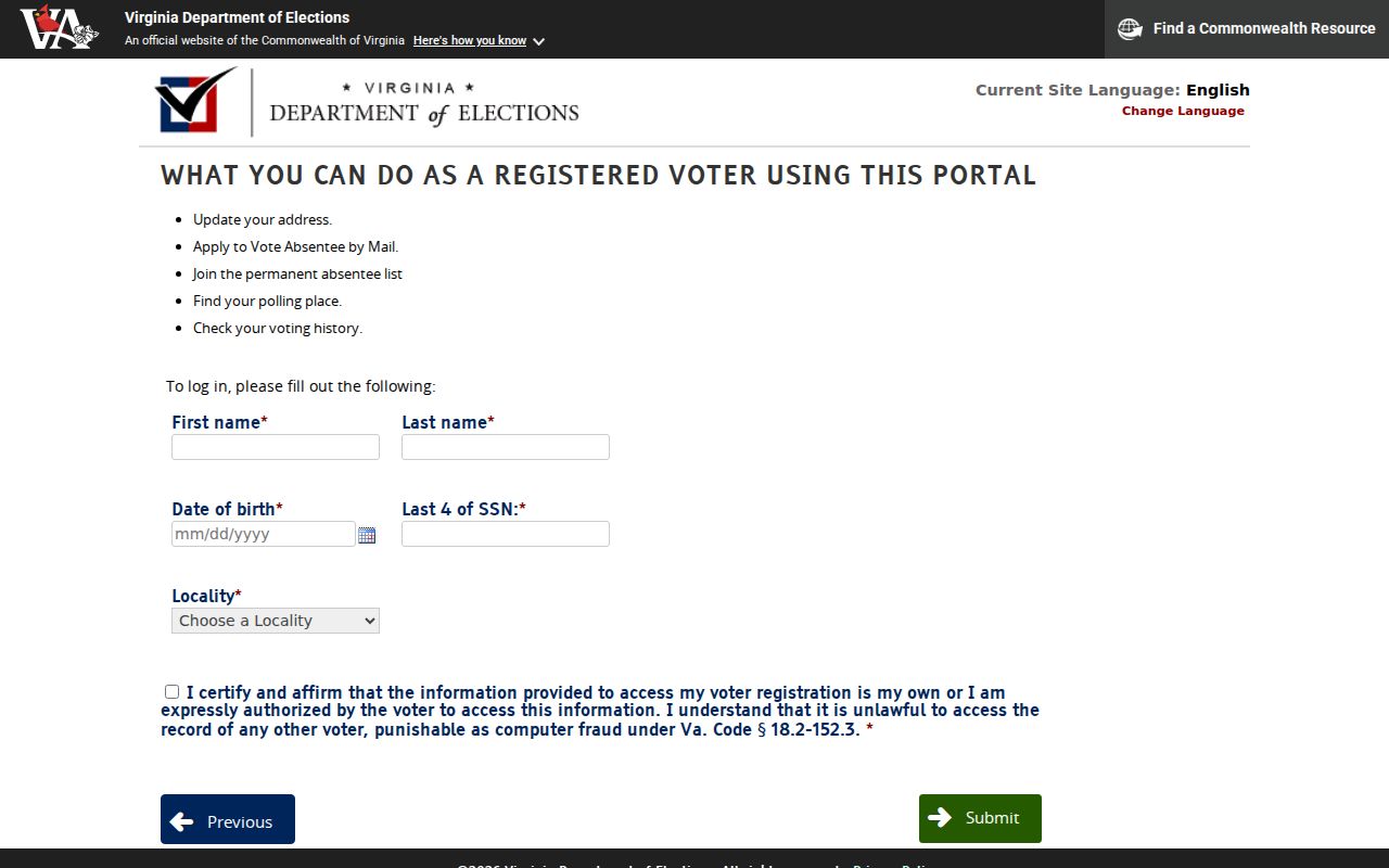
The form supports a person-specific status check, not a Chesterfield street-by-street list of voters.
Address-Keyed Chesterfield Street Records
These Chesterfield records answer different address questions. The parcel record is best for current assessment and ownership data. The deed chain connects recorded transfers. GIS explains where the tract sits. Permits and older directories fill distinct time periods. None is a complete household roster, so compare sources and keep their dates separate.
| Address record | Custodian | Useful result | Access channel |
|---|---|---|---|
| READ parcel record | Real Estate Assessments | Parcel ID, ownership, mailing and situs data, improvements, history | Free public application |
| Parcel Viewer | Geospatial Services | Boundaries, nearby parcels, subdivision, schools, districts | Free map viewer and GIS hub |
| Land deed and plat index | Circuit Court Clerk | Parties, recorded transfer, legal description, plat reference | Online deed index from 1967; Record Room, LVA, and FamilySearch for earlier work |
| ELM permit or inspection | Community Development | Address, permit type, review or inspection status | Citizen Access Portal; some submissions require an account |
| Printed reverse directory | Central Library and LVA resources | Dated address and possible occupant clue | Library, databases, or microfilm; local run needs desk verification |
The state voter file is a separate controlled channel, not an added row in a public street browse. Its individual portal and authorized list-request process should be used only within their stated rules.
Chesterfield Street Records Cross 1967
Chesterfield's permanent land and court records begin in 1749, but the convenience layer is much newer. The Clerk posts deeds from 1967 forward online and wills from 1994 forward. That gap is a useful warning for a street directory search that reaches into an older subdivision, farm tract, or historic community. The online index ending is not the start of the physical record series.
At the cutoff, keep using the same names, dates, parcel clues, and legal descriptions. The Record Room has the permanent series, and the Library of Virginia Chesterfield microfilm catalog identifies historic county material. FamilySearch lists Chesterfield deed books from 1749 to 1866 and general indexes from 1749 to 1913, subject to each collection's viewing rules.
Chesterfield Street Records Near Manchester
Historic Manchester makes an address search date-sensitive. Manchester became an independent city in 1870 and later joined Richmond. Richmond's 1970 annexation also moved 27 square miles and more than 47,000 former Chesterfield residents into a different jurisdiction. An old address with a Richmond or Manchester label may need Richmond City records even when a modern search begins in Chesterfield County.
The 1869 Boyd directory item for Manchester and the 1895 Manchester Sanborn sheets show why place labels deserve attention. Compare the street grid, map, date, and legal description before deciding which custodian should hold the next record. For a deeper run through dated printed listings, use the Chesterfield city directory collection path.
Note: A Richmond mailing city or ZIP is delivery geography, not proof of the parcel's present or historic government jurisdiction.
Limits of a Chesterfield Street Directory
A street directory can identify public parcel and document clues, but it cannot establish every person at an address. A parcel owner is not necessarily the person at the situs address. Addressed records do not provide a general list of children, guests, private association members, utility customers, school households, or people whose addresses are protected. Driver and vehicle information is also restricted under the federal Driver's Privacy Protection Act and Virginia release rules.
Virginia's Address Confidentiality Program and protected-voter rules allow qualifying people to use substitute or protected addresses in public-facing records. Use a missing result as a reason to check the right custodian, not as a claim about a person. Public records also change, and assessment updates can lag recorded transfers.
Lawful use. Chesterfield street and address records are for personal, lawful research such as family history, property questions, and civic curiosity. Do not use a record to stalk, harass, intimidate, or harm another person.